

Knocknamuck [Cnoc na Muc]
Good walks are even better shared.
Overview
Knocknamuck [Cnoc na Muc] - An Overview
Knocknamuck, or Cnoc na Muc, stands proudly at 481 meters in the Slieve Bloom Mountains. With its charming name, meaning 'Hill of the Pig', it adds a delightful touch to your hiking experience.
Geology
The underlying geology consists of schist and quartzite. This unique composition results in a mix of rugged and solid terrain, perfect for both seasoned and novice hikers alike. The rocks here can tell stories of ancient geological forces—just don’t expect them to spill any secrets!
Routes
One of the most recommended routes starts from Cadamstown. This moderate hike spans roughly 6 km and typically takes about 2.5 hours. As you wind your way up, you’ll be treated to picturesque views and a variety of natural vegetation.
Summit Features
Upon reaching the summit, hikers are greeted by a large stone cairn and a trig point—ideal for that panoramic selfie! Just try not to let the wind steal your hat.
Terrain
Expect a mix of rocky and grassy areas, with the occasional boggy spot to keep you on your toes. A sturdy pair of boots is advised to navigate the terrain comfortably.
Views
The views from Knocknamuck are nothing short of spectacular. On a clear day, you can see the rolling hills of the Slieve Bloom Mountains and even catch a glimpse of the Galtee Mountains in the far distance. For the best vistas, plan your hike during spring or autumn when the sights are at their most vibrant.
Hazards
While this is a fantastic hike, remember that loose rocks and slippery conditions can crop up, especially after rain. Always tread carefully!
Access
Parking is available in Cadamstown, though it's limited, so it’s best to arrive early. If relying on public transport, be prepared for some walking, as the services to the village are sparse. The nearest town is Birr, which offers more in terms of facilities and amenities.
Facilities
Facilities in Cadamstown are minimal, with only a small pub available. For a proper meal or restroom facilities, you may need to head back to Birr.
History
The folklore of Knocknamuck adds depth to your hike. Its name reflects a cultural connection, potentially connected to past livestock or local legends.
In conclusion, whether you are an avid hiker or just looking for a peaceful walk in nature, Knocknamuck offers a delightful escape into the Irish countryside. Just remember, it’s not just a hill; it's a slice of history!
Happy Hiking!
Explore routes near Knocknamuck [Cnoc na Muc]
Public walks starting within 80 km of this hill. Nearby does not mean a route reaches the summit; check its map and access before setting out.
No public routes are currently listed within 80 km of Knocknamuck [Cnoc na Muc] on Walkmates. This does not mean there are no paths here. Explore the map and check local access information before planning a walk.
Route planning notes
These notes describe possible approaches, not verified navigable routes or permission to cross land. Check current paths, local access rules and conditions before setting out.
From Cadamstown
A scenic ascent starting at the small village of Cadamstown, this route leads you through lush landscapes and offers stunning views as you approach the summit.
Make a day of it, together
Find someone to share the walk with, or organise a day out along a route you like.
Photo Gallery
View all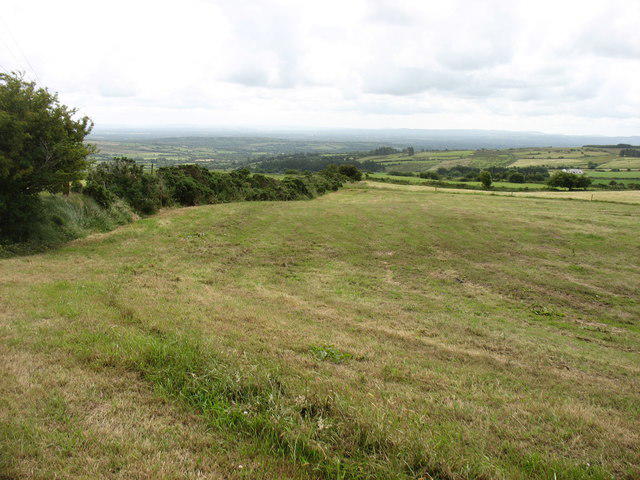 Photo could not load
S3154 : Farmland south-east of Knocknamuck
David Purchase
Hill facts and local notes
Classifications
Elevation
340m
1,115 ft
Prominence
205m
Coordinates
52.6448, -7.5324
S317549
OS Map
67
At the Summit
The summit features a large stone cairn and a small trig point that offers a great photo opportunity.
Terrain & Geology
Knocknamuck is primarily composed of schist and quartzite, creating a rugged terrain that provides a solid footing for hikers and excellent views of the surrounding landscape.
Views & Scenery
From the summit, enjoy sweeping views of the Slieve Bloom Mountains, the surrounding valleys, and on clear days, the distant peaks of the Galtee Mountains.
History & Heritage
Name Origin
Cnoc na Muc translates to 'Hill of the Pig' in Irish, perhaps a nod to a local tale or the wildlife that once roamed these hills.
Historical Significance
The area is rich in folklore and offers insights into Celtic history, making this not just a hike but a walk through time.
Getting There & Facilities
Check current local access restrictions, parking rules and transport timetables before travelling. These notes do not confirm public access to the summit.
Parking
There is limited parking available at the Cadamstown village. Look for designated parking areas on the village outskirts.
Public Transport
Public transport is limited; the nearest bus service connects from Birr, approximately 15 km away.
Nearby Facilities
Cadamstown has a small pub, but facilities are limited, so plan ahead. The closest cafes and toilets are in Birr.
Safety Information
Known Hazards
- Be cautious of loose rocks on the path. In wet conditions, some areas can become slippery and boggy.
General Safety Tips
- Check weather conditions before setting out
- Carry appropriate clothing and equipment
- Let someone know your planned route
- Take a map, compass, and GPS device
- Carry emergency supplies: food, water, first aid kit, torch
Hills
Some common questions about the hills answered
Are there group walks up Knocknamuck [Cnoc na Muc]?
Many walkers use Walkmates to join or organise walks with others. You can check for group walks around Knocknamuck [Cnoc na Muc] through the maps
Are there other walkers around Knocknamuck [Cnoc na Muc]?
Activity varies by location and time, but Walkmates lets you see whether others have shared walks or shown interest in this area. Find other people through the walking friends search walking friends for Knocknamuck [Cnoc na Muc] search or of course create your own walk for Knocknamuck [Cnoc na Muc]
Can I organise a walk to Knocknamuck [Cnoc na Muc]?
Yes. If there aren’t any walks listed already, you can create a walk and make it available for others to join.
If you're signed up to Walkmates, you can create a walk to Knocknamuck [Cnoc na Muc].
How do I find a walk up this hill?
There are often multiple ways to walk this hill, depending on experience and route preference. Walkmates helps you explore walks and routes that others have shared.
Can I suggest a new route up Knocknamuck [Cnoc na Muc]?
Yes. You can suggest or create routes to share with others. Walkmates focuses on the social side of walking, so routes are used to help people organise walks and explore areas together, rather than as detailed navigation tools or route libraries.
Other uses really appreciate knowledgeable walkers sharing their routes. Share your favourite route to Knocknamuck [Cnoc na Muc] here
The is an error or something incorrect about this hill. How do I let you know?
We always strive to keep the information on Walkmates as accurate as possible. If you find an error, please let us know through the contact form and we'll aim to correct it as quickly as possible
Community Discussion
Comments
Location
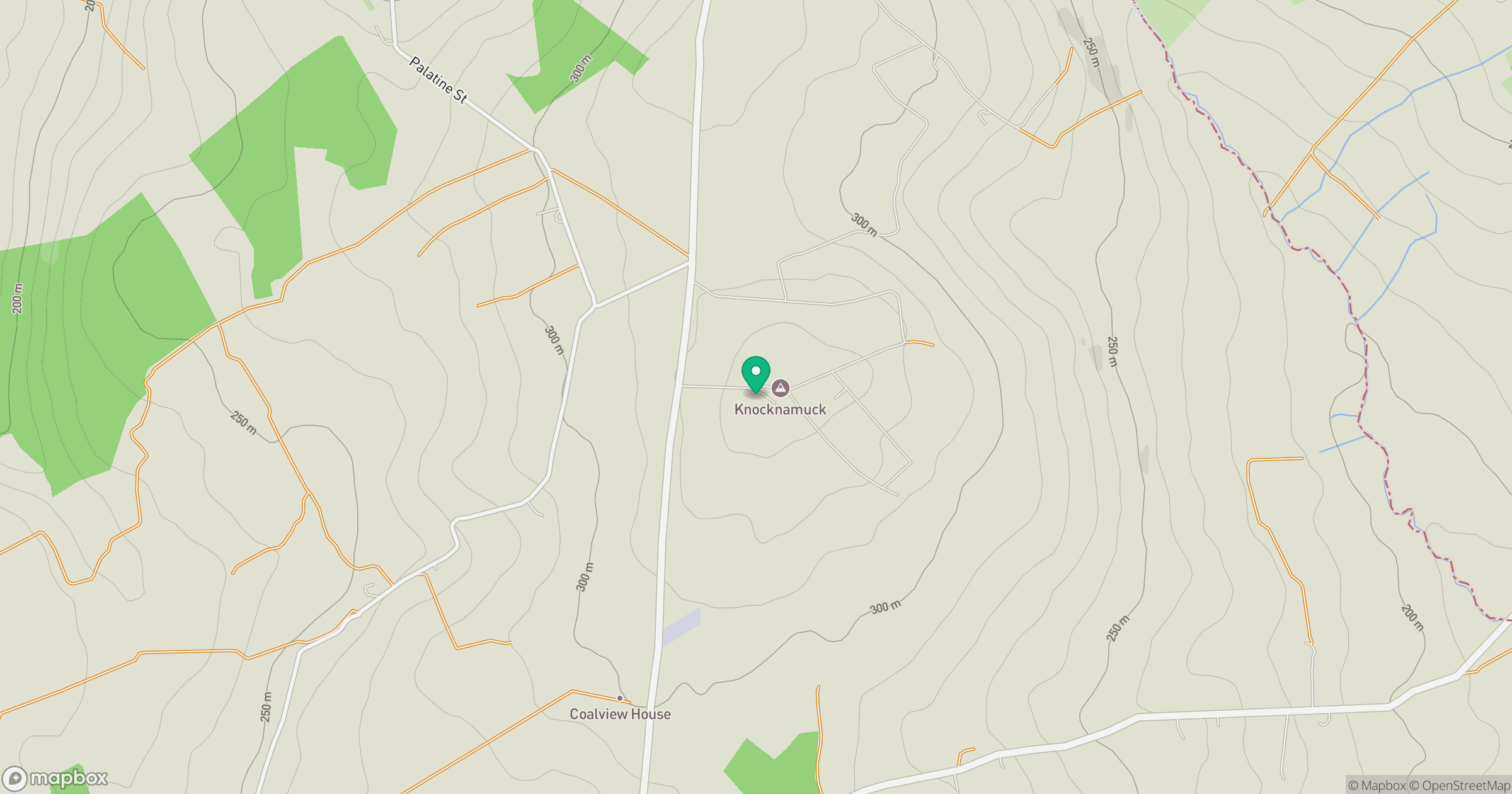
Grid reference: S317549
View on OpenStreetMapOpens a map in a new tab, centred on the hill.
Hills within 30 km
Straight-line distance, not a walking route or confirmation of access.
Clomantagh Hill [Killoshulan] [Cnoc na Cloiche Mantai]
349m
Knockmannon Hill
313m
Slievenamon [Sliabh na mBan]
720m
Carrigadoon Hill
297m
Killough
235m
No comments yet. Be the first.